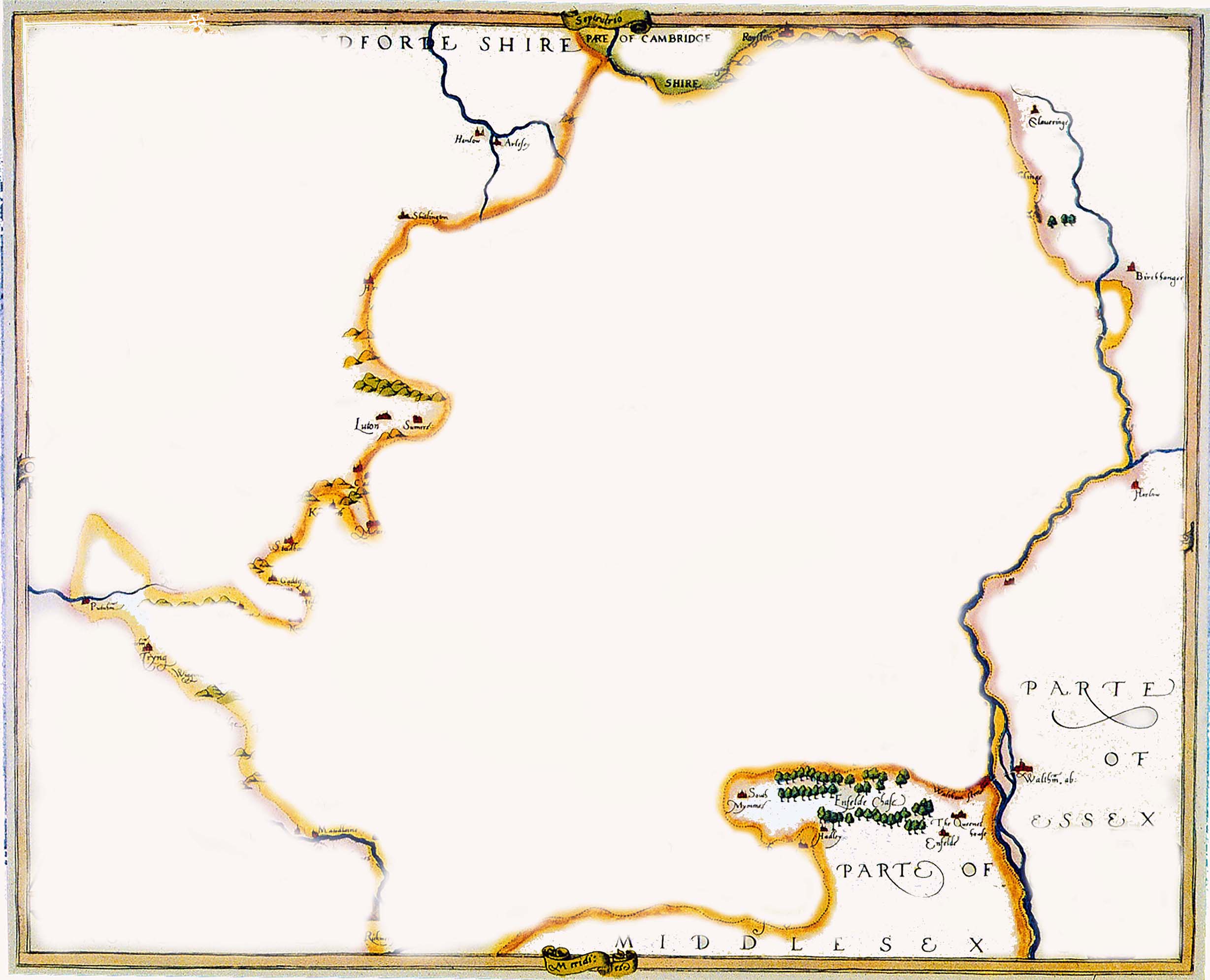
At Hertfordshire Archives & Local Studies, we have hundreds of maps of the county, the oldest one, which you can see below, was made while Queen Elizabeth I was on the throne.
Have a look at the way the towns, rivers and forests are shown. How accurate do you think it is? The Tudors were very keen on exploring, so map-making started to become more accurate from this point. If you’d like to find out more fun facts about maps, download the PDF sheet at the bottom of the page. A copy of this map can also be purchased at Hertfordshire Archives and Local Studies when we reopen.

The oldest county map of Hertfordshire: The Saxton Map of Hertfordshire, 1577 (HALS Ref: CM2) Copyright Hertfordshire Archives and Local Studies ©
Why not make your own town or county map using original map features from maps in Hertfordshire Archives and Local Studies?
NB: This activity is suitable for children aged 7+ but will require an adult for supervision.
You will need white paper, scissors, and glue.
- See below the outline of a county map. Right-click on this and chose Print Picture from the drop-down menu.
- Now right click on the map features to cut and stick. Choose Print Picture from the drop-down menu.
- Cut around the map features and stick them to your chosen map
- Share pictures of your finished map with us on Twitter @HertsArchives with the hashtag #MarvellousMaps.
We look forward to seeing your creations!
County Map outline – copyright Hertfordshire Archives and Local Studies ©

Map features – copyright Hertfordshire Archives and Local Studies ©
All images copyright Hertfordshire Archives and Local Studies ©


Add your comment about this page