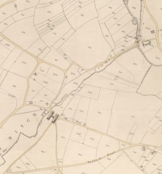
The River Hiz, rising just outside Hitchin, at Wellhead, Charlton, can be followed through the town and out through Ickleford to Arlesey and beyond. Beautiful stretches of countryside alternate with urban scenes and it is fascinating to discover along its length the story of Hitchin’s history and development, using historical maps such as the Tithe maps of c1844 and the Inland Revenue maps of c1910. (These maps can be viewed at Hertfordshire Archives and Local Studies). Hitchin went through an unprecedented level of growth in the 60 year interval between these maps but in following the watercourse you can still find traces of the rural charm of a small country town of the nineteenth century.
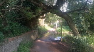
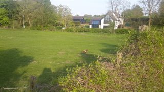
The source of the River Hiz can be found just beyond Charlton. A footpath leading to the spring is just off the road between Charlton and Preston, just after the pumping station. The river follows the course of the road into Charlton, passing farms marked on the 1844 map, the birthplace of Henry Bessemer and the, now sadly shut, Windmill PH. The Windmill is marked as pub on the 1911 map but not in 1844. A small amount of work cross referencing Tithe maps and census returns, which began in 1841, would provide names for the residents of these farms and buildings.
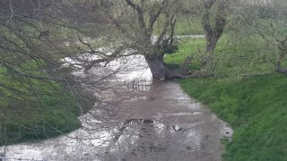
The River Hiz by the Windmill PH
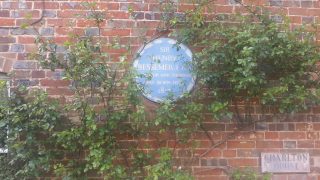
The blue plaque outside Bessemer’s birthplace
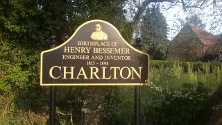
Charlton’s village sign
The Hiz as it borders the road to Preston
Farm houses by the river
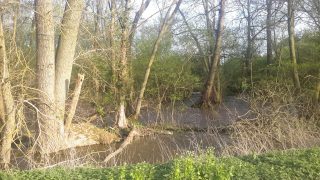
The river just below the source
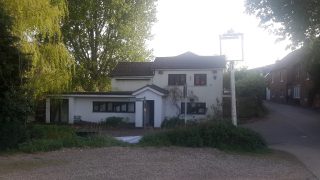
The former Windmill PH
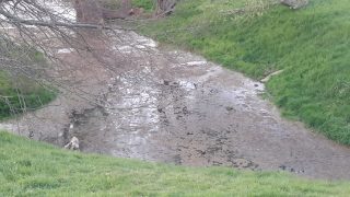
The river’s source at Wellhead
The Hiz at Wellhead
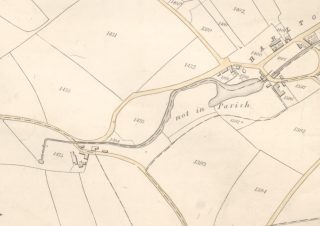
The 1844 Tithe map (reference DSA4/53/1)
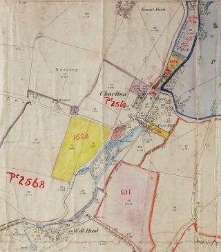
The Inland revenue map of 1910/1 (reference IR1/105)
Priory Park

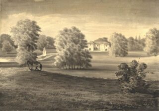
The Priory c1780 – 1800. ref: CV/HIT/17.
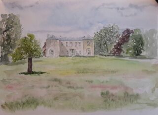
The Priory 2020
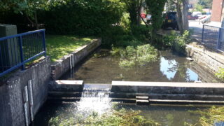
The Hiz by the Biggin
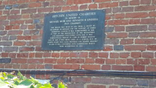
Plaque giving the history of the Biggin
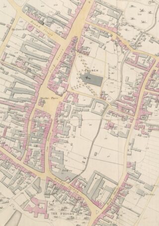
Hitchin town centre in 1844
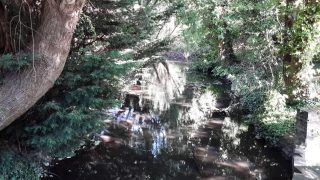
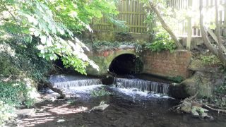
The river fords the road just by the Windmill and passes behind houses bordering the Charlton Road. You can pick up the river further down the road taking the footpath that crosses as the Priory Park. The river skirts the park and passes underneath the Parkway bypass, entering the Hitchin Priory grounds, and emerging at the junction of Tilehouse and Bridge Streets. The two views of the Priory shown here hardly differ, despite the 200 year gap! You can follow the river a short way but will be obliged to turn back and pick up the river again as it borders the car park behind the Sun Hotel and passes the ancient ‘Biggin’, a timbered structure of great antiquity.
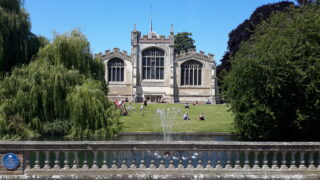
St Mary’s parish church in Hitchin town centre
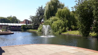
The fountain before St Mary’s church
The river then broadens out before the iconic prospect of St Mary’s Parish Church, passes beneath Portmill Lane and then again under Hermitage Road.
Whilst Charlton would probably still be recognizable to the villagers of 1844, the changes in Hitchin Town Centre are the most dramatic. Brewery buildings at the junction of Sun Street and Bridge Street are long gone – they were replaced by Crown House, and subsequently by recent flats – Queen Street was called Dead Street in1844 (a reminder of the plague deaths in the seventeenth century) – the prospect before St Mary’s was then a warren of yards and ‘slum housing’. Portmill Lane still had a mill! Hermitage Road did not exist, being then the gardens of the Seebohm estate fronting Bancroft.
The Hiz by Ransom’s Walk
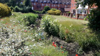
The Hiz beyond Hermitage Road
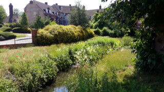
Ransom’s Walk stretch
The river emerges from the far side of Hermitage Road and can be accessed from the road ‘Ransom’s Walk’ off Whinbush Road. In 1844 this area was undeveloped apart from some buildings running back from Bancroft and the Russells Tannery by the river itself. The river has two 90 degree bends in this stretch, clearly marked on the 1844 map and still follows this course today.
Cottages by Starlings Bridge
The former gasworks by Starlings Bridge
The 1844 Tithe map of the Grove Road area of Hitchin
A pleasant path follows the river through this new housing estate, past Sainsbury’s Supermarket and around the far edge of Bancroft Recreation Ground. This land in 1844 was osier beds and nurseries but was purchased by the Hitchin Urban District Council in 1924. A path crossed this area diagonally from Bancroft to Starlings Bridge that was called the ‘Gas Path’. Hitchin’s first gasworks were built here by Starlings Bridge in 1834 and are shown on the 1844 map, with the circle of the gasholder clearly marked. The gas holder itself lasted until 1949. This site has now been redeveloped as a gated housing community, but the former buildings have survived at the roadside.
To the right of Starlings Bridge are some cottages which were standing in 1844, although the pub next to them, the ‘Woolpack’ (built in 1840 by a W Foss) and the smithy which stood in its yard, are long gone, demolished to make way for housing. An orchard ran alongside the Hiz.
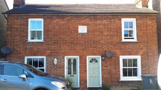
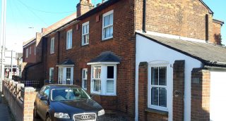
Nightingale Cottages
The area of town beyond this, Nightingale and Grove Roads, was largely undeveloped in 1844, although a lone pair of cottages stood on what was to become Nightingale Road, still called Nightingale Cottages with the date, 1844, visible on the front.
The Hiz passes under Nightingale Road and runs up behind houses on Grove Road and can be joined again in Ransoms Recreation Ground. This area was Ransom’s cow meadows in 1844. The recreation ground opened in 1929. The railway did not exist in 1844 and the attractive cottages, ‘Midland Cottages’, that border the area were yet to be built. The fascinating book, ‘Discovering Hitchin’ by Priscilla Douglas and Pauline Humphries published by Hitchin Historical Society, is a mine of information on the growth of this area of the town. It is interesting to note that the basic layout of the roads in this area did not change from 1844 to the present day, despite the building boom.
The river by Grove Road
The railway arches over Grove Road
The Rivers Purwell and Hiz as they join at Grove Mill.
The river runs alongside Grove Road, underneath the railway bridge, to join with the River Purwell at Watersmeet by Grove Mill.
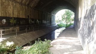
A parapet for a spur linking the railway and the industrial estate.
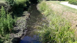
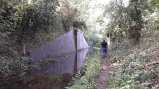
The river can be followed in a narrow tunnel of green, bordered on the one side by the railway and the other by the industrial estate running along Cadwell Lane. The chalk river can be heard ‘chuckling’ over its stony riverbed in places in a surprising reminder of its peaceful, rural past.
The next article will cover the Hiz from Hitchin to Ickleford.


Add your comment about this page
I frequently walk the Hicca way and endorse your description and photos fully .
One I would suggest adding a photo of the old building on the bridge itself in Bridge street which predates the bridge itself and one can see the steps leading into the house from the river bank .
I look to your description of further walks and photos from Hitchin to Ickleford
16/1/21
Thank you for your comments! I am glad you have enjoyed the same walks! I intend to add Part II, covering the walk from Hitchin, through Ickleford, to Arlesey and beyond. Currrent lockdown has meant that I have not had access to all the maps for reference.
Hi there,
I was delighted to stumble upon this section of your pages today. We did exactly the same thing during Lock down 1, walked the course of the river Hiz/Purwell as far as Arlesey. It is now our intention to follow the Kingfisher Way going North. We made a start on this towards the end of lockdown, by walking from Ivel Springs in Baldock to Arlesey. We have also revisited the Springs at Oughtonhead. We both think that all these Springs should have signposting and a sign marking them as sources. We struggled a bit today to find the actual Wellhead at Charlton as the maps are not that clear, and signage pretty non existent, at least from the direction we came from – Hitchin to Preston, then back via Charlton. But these pages are brilliant – especially with the photos too and the old maps. Keep up the great work. Thank you.