


 Gardens is Pixmore Way.")

Please leave a comment.
Aerial Views of Letchworth
Can you recognise the places in these photos?
A 1930s view of the town with the railway station in the bottom right-hand corner, the Colonnade and Town Hall in the centre and Broadway, stretching pass them to the top left-hand corner, in a south-south-west direction.
The Citizen Newspaper
This more modern view, looking south from Station Place, shows Eastcheap from HSBC and the Colonnade, now the Hog's Head, to the Town Hall, Library and Broadway Cinema.
Aerofilms
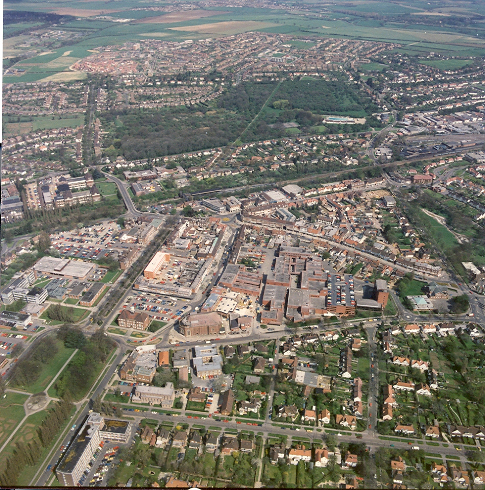
This is a view looking north-east over the Town Hall and Broadway Cinema, then Leys Avenue, to Birds Hill and the railway-line in the top left.
Aerofilms
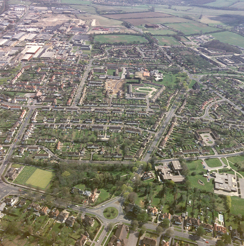
This view is looking over the Town Hall and Broadway Cinema to the north of the town. Norton Common is clearly seen with a glimpse of Stotfold at the top. Running across the bottom from Broadway (Kennedy) Gardens is Pixmore Way.
Aerofilms
This is a view of the eastern part of town, looking along Pixmore Way to where it meets the Baldock Road, with Norton Way South running across the bottom. Jackman's Place and the Recreation Ground can be clearly seen with a glimpse of Baldock at the top.
Aerofilms
This page was added on 02/07/2010.


Add your comment about this page